Antique Greek World
Before 0 AD
Late Antiquity World -
Ptolemaic Maps -
European Türks -
Huns at the beginning of the New Era
Links
World according to Hecataeus 6th century BC
.gif)
Reconstruction of Herodotus World Map, ca. 450 BC
Herodotus shows Araxes east and west of the Caspian Sea, which explains the Alexander Macedonian 331 BC war story about crossing Araxes. It took another hundred years for the Greeks to learn enough about the Central Asian geography to show Cheyhun, under the name of Oxus, on the maps attributed to ca. 200 BC.
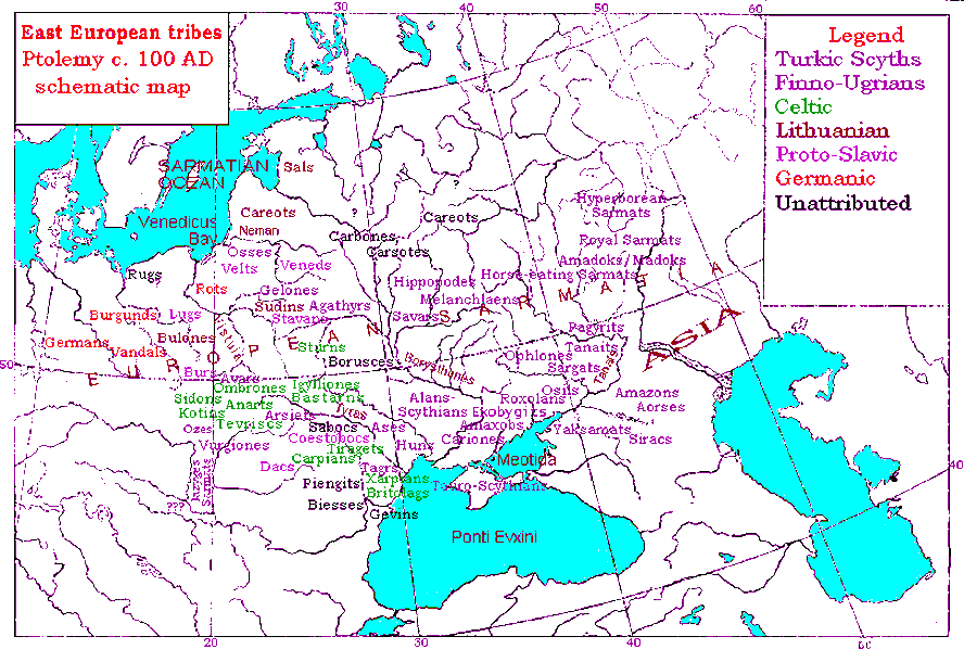
Herodotus uses the Türkic word for nomads, Iyrk, to call the "Iurcae" the nomads northeast of the Caspian, he uses a Türkic derogatory moniker "Iarymspu", "half-eyed", for Arimaspi, the squinted-eyed nomads northeast of Sogdiana, and locates the Türkic Ases under the name "Issedons" in the steppes east of the Caspian, where his Chinese contemporaries also located Ases as "Wusuns/Usuns". In between Tanais and Cuban, Herodotus uses the Türkic word for people, Budun, to call the "Budini", and also shows their tribal name, "Geloni", from the Ogur Türkic "Gelon" - Snake. In the Northern Pontic steppes, Herodotus locates Ases, calling the land "Scythia", akin to the Assyrian "Ish-Guz" for "As-Guzes", Oguz Türkic "As-Tribe". And further west Herodotus uses the Türkic word "Agach-Eri", "Forest People", to name the "Agathyrs" in the more wooded area. The names Budini and Agathyrsi could be exo-ethnonymic appellations , given by the Scythians to their non Türkic-speaking neighbors, and later applied to the historically attested Türkic people. The non-distorted pronunciation of the words shows that that the Greek informers received these terms directly from the Türks.

Reconstruction of world map according to Dicaearchus, ca. 300 BC
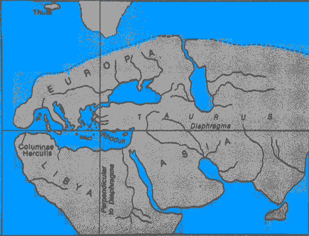
World map according to Eratosthenes, ca. 194 BC
.jpg)
World map according to Posidonius 150-130 BC
.jpg)
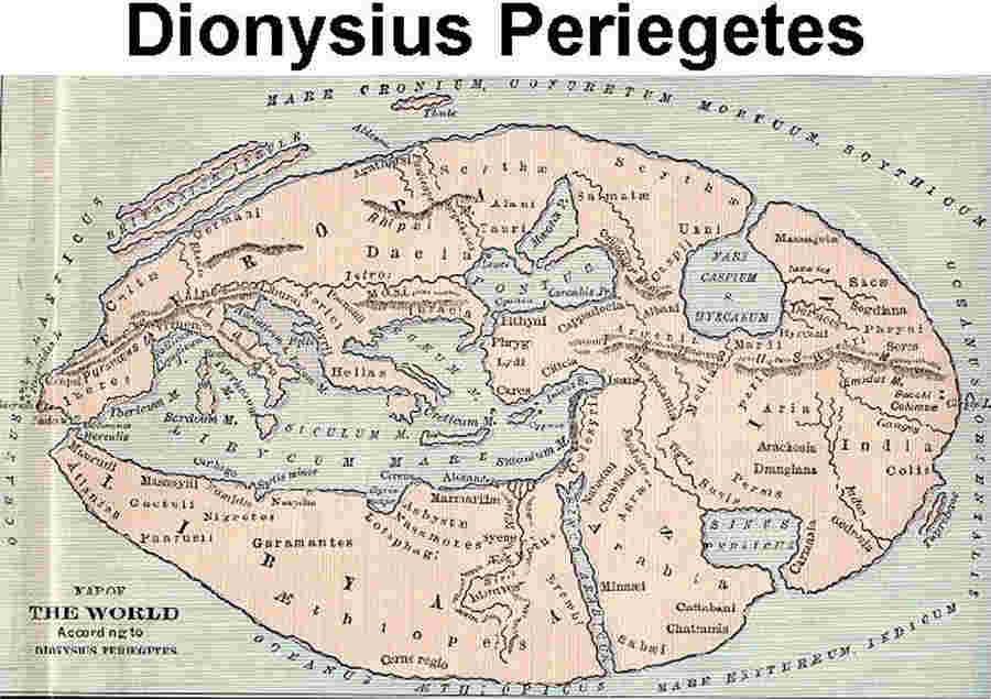
Dionysius Periegetes Map ca. 124 AD (the range is 3rd c. BC - 138 AD)
Source
Notes